The Technology Behind Pavement Management: Ground Penetrating Radar

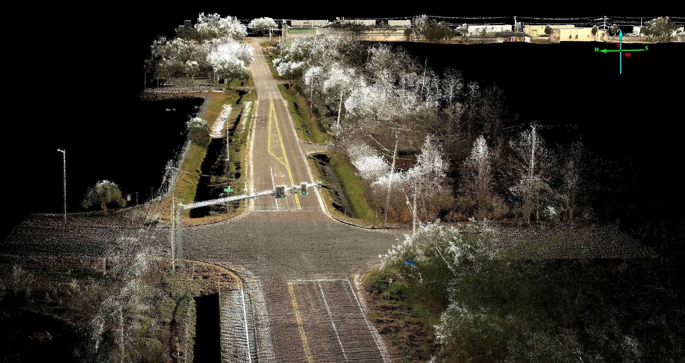
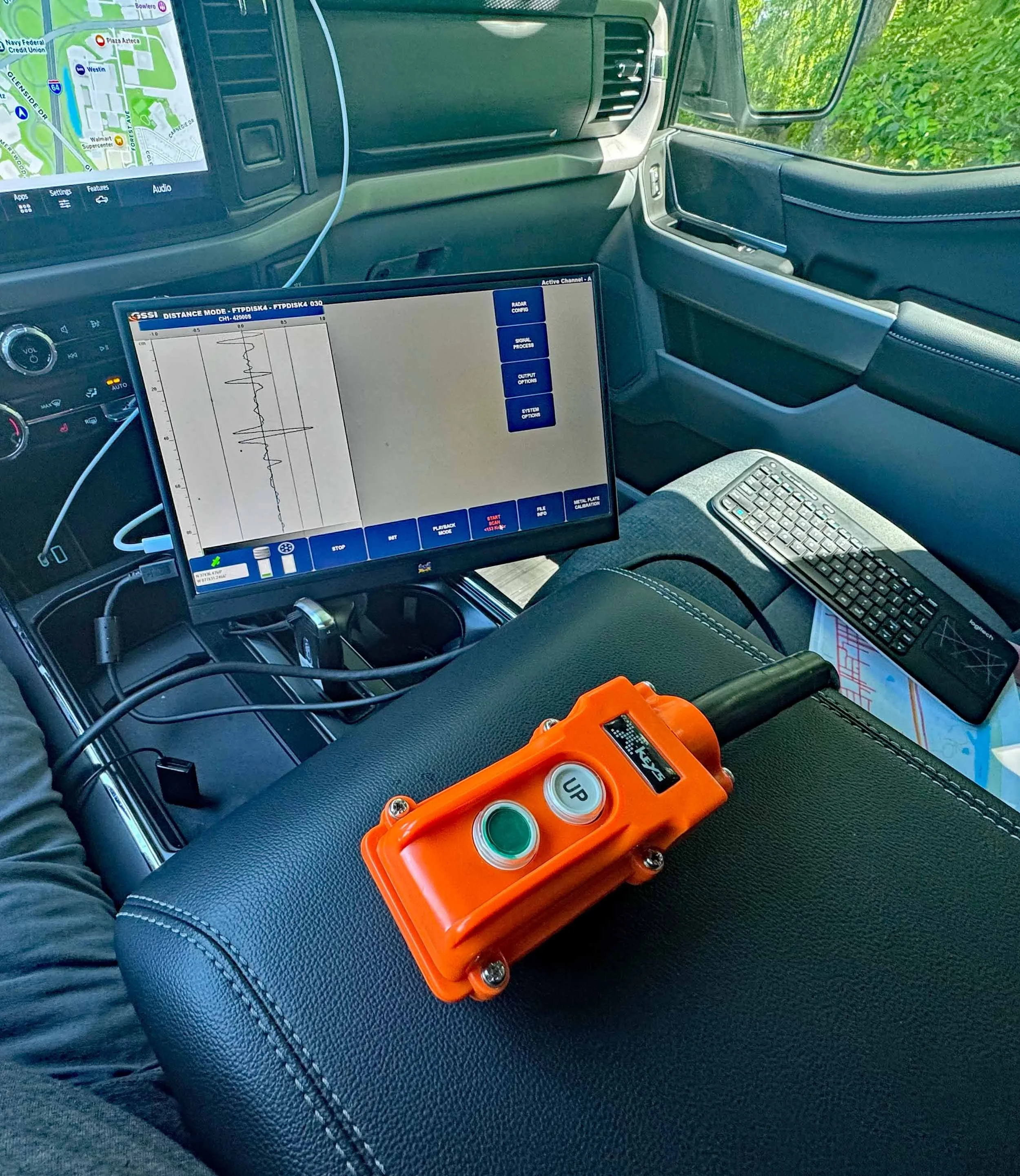
View of Radar Data from Ground Penetrating Radar
The Use of Ground Penetrating Radar in Pavement Data Collection
Effective pavement management is essential for maintaining a safe and durable infrastructure. Ground penetrating radar is a non-destructive tool for roadway data collection.
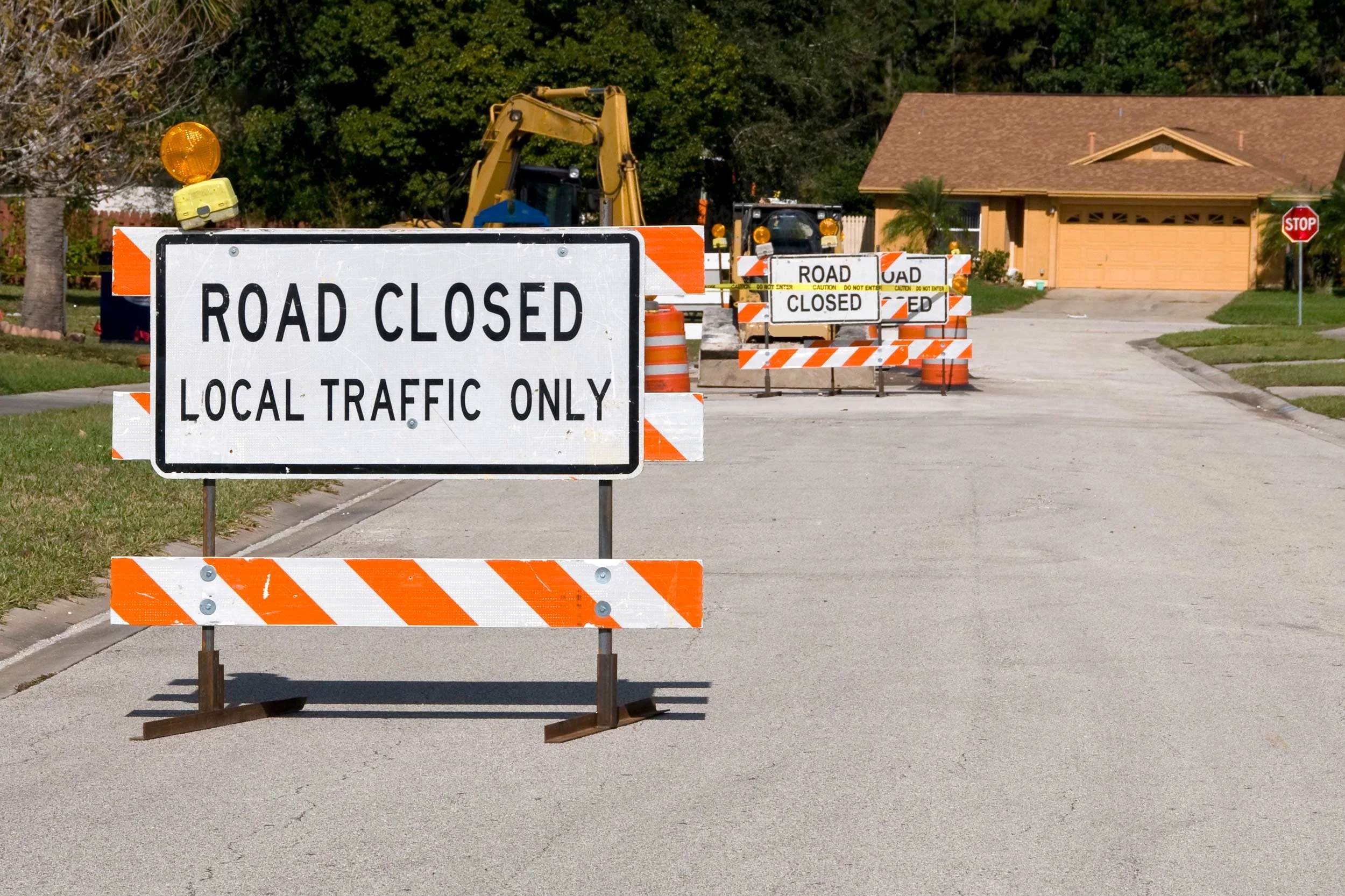
Local roads, highways, parking lots, trails, and other paved surfaces endure constant wear and tear. This makes regular assessments and proactive maintenance critical. In the past, pavement evaluation was a labor-intensive, subjective, time-consuming, and costly process. Technological advancements have transformed the industry, allowing faster, more accurate, and less disruptive data collection and assessments.
Since 2002, Transmap has been using ground-penetrating radar (GPR) for data collection and pavement analysis. GPR is a non-destructive technology that provides deep insights into roadway conditions without the need for digging or drilling cores. Ground penetrating radar uses electromagnetic waves to detect subsurface conditions, anomalies, and features, helping assess pavement thickness and voids, to identify structural weakness.
In this post, we’ll explore how GPR is used to make more informed decisions in pavement assessment and management, how it can help to reduce costs, and how the use of GPR contributes to more efficient infrastructure management.

What is Ground Penetrating Radar (GPR)?
Ground penetrating radar is a non-destructive testing technology used to assess subsurface conditions without disruptive excavation. GPR operates by emitting high-frequency electromagnetic waves into the ground and then analyzing the reflected signals. The variations in the reflections provide valuable data on pavement structure, layer thickness, and any underlying issues like voids or moisture intrusion.
How GPR Works
GPR sends short pulses of electromagnetic energy in the microwave frequency range into the pavement surface. As the waves travel through various materials, they encounter boundaries between the layers – like asphalt, concrete, or soil – causing some energy to reflect to the receiver while the remainder continues downward.
The reflected signals are then recorded and analyzed to create a detailed subsurface profile. This helps engineers assess pavement integrity without the disruption of taking destructive core samples or excavation.
Ground penetrating radar is used in infrastructure maintenance and pavement management because of its ability to quickly and accurately assess subsurface roadway conditions. Common applications include:
• Roadway and Highway Assessment
GPR helps to determine pavement thickness, locate defects, and detect roadway deterioration before visible damage appears.
• Bridge Deck Evaluation
Ground penetrating radar can identify rebar placement, corrosion, and structural defects or weaknesses in bridge decks.
• Utility and Subsurface Mapping
GPR is instrumental in detecting buried utilities, pipelines, and voids beneath roadways. This helps to prevent costly excavation errors.
By leveraging GPR technology, pavement management professionals and agencies can make informed decisions to extend roadway longevity, reduce maintenance costs, and improve infrastructure safety.
The Process of GPR Scanning: Data Collection and Interpretation
Ground penetrating radar scanning is a systematic process. It consists of three distinct elements. First, data is collected by a GPR unit mounted on a vehicle or pushed manually. The unit transmits high-frequency electromagnetic waves into the pavement. They penetrate the surface and reflect the different layers, objects, and materials based on their properties. The reflections are captured by a receiver to create a real-time dataset.
Next, the data is processed using specialized software that converts the collected signals into visual information like depth profiles or 3D subsurface maps. The processed data is then analyzed to assess pavement conditions, identify defects, and determine a course of action. The data can reveal anomalies like voids, moisture infiltration, or layer separations not visible on the pavement surface.
GPR technology offers insights into pavement conditions, including:
Layer-Thickness – GPR accurately measures the depth of asphalt, concrete, and any underlying base layers without manual coring.
Moisture Content – GPR can detect moisture trapped within the pavement layer. This can indicate potential weakness and deterioration.
Voids or Air Pockets - GPR can detect hidden voids beneath the surface that could lead to pavement failure if not addressed.
Structural Integrity – GPR data analysis can evaluate the condition of subsurface layers to detect inconsistencies and potential weaknesses that may need repair.
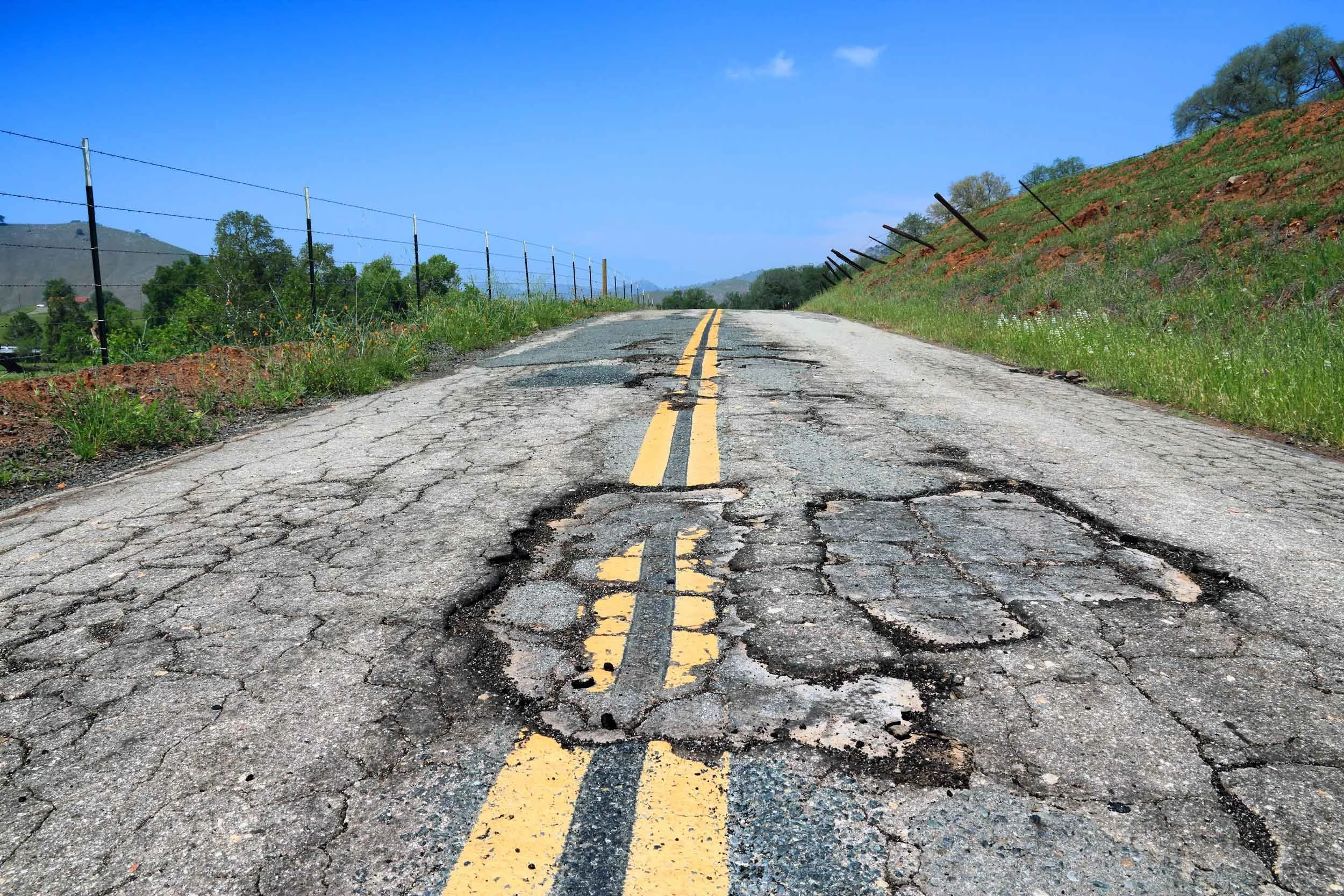
Traditional Inspection vs. GPR Assessment
In the past, traditional pavement evaluation relied on physical coring, drilling, and visual inspections. The process was time-consuming, labor-intensive, subjective, and sometimes destructive. While these methods did provide valuable data, there were some limitations.
Coring and drilling are invasive, disruptive to traffic, and provide localized data, not a comprehensive assessment.
Visual inspections depend on surface observations, which can miss deeper structural issues.
Falling weight deflectometer (FWD) testing assesses pavement response to loads but does not detect subsurface voids and material variations.
GPR Assessment is a non-destructive, rapid, complete, and continuous assessment of subsurface pavement conditions. Modern technology has minimized traffic disruptions, covers large areas efficiently, and provides a more detailed view of subsurface conditions.
By leveraging GPR, agencies and contractors can make data-driven decisions, extending roadway lifespans and reducing repair costs.
GPR Use in Pavement Management
Since 2002, Transmap’s data collection vehicles have included GPR technology. We have been at the forefront as technology has continued to evolve, making pavement assessment more efficient and data driven as opposed to traditional visual inspection and subjective analysis.
As infrastructure maintenance has shifted toward predictive strategies, GPR plays a major role in shaping pavement management and smart city planning. Transmap's use of this cutting-edge technology has helped cities and towns to make informed decisions when planning repairs and maintenance. GPR data has saved agencies thousands of dollars over more traditional (and destructive) methods.
Some significant advances in GPR technology include:
Incorporation of AI-Powered Data Analysis
The collection of data using GPR produces large quantities of data. Advancements in artificial intelligence and machine learning have allowed faster analysis of large amounts of data, with greater accuracy.
Traditionally, GPR data interpretation requires skilled experts to manually analyze waveforms to identify subsurface conditions. AI-driven algorithms can process vast amounts of data in real-time, detecting patterns, anomalies, and potential issues with higher accuracy faster than manual data analysis. AI automation reduces human error, enhances decision-making, and accelerates road maintenance planning.
Integration with GIS
Modern pavement management relies on Geographic Information Systems (GIS). Ground penetrating data can now be integrated with GIS platforms to allow city planners and engineers to visualize subsurface conditions with other critical infrastructure data.
This connectivity allows for more comprehensive asset management, helping agency decision-makers prioritize repairs and allocate limited resources more effectively.

Ground Penetrating Radar Map Results
GPR’s Role in Predictive Maintenance and Long-Term Planning
As cities and towns expand and their roadway and transportation networks become more complex, proactive, predictive maintenance is essential for sustainable pavement management. GPR is a key tool in this transformation, allowing agencies to move from reactive to proactive maintenance strategies. By regularly assessing pavement conditions, municipalities can better predict potential roadway failures before they become costly issues impacting roadway safety.
In city planning and infrastructure maintenance, GPR contributes to optimizing construction projects and reducing disruptions, ensuring long-term sustainability. With the ability to detect subsurface utilities, voids, and material inconsistencies, GPR helps agencies design more resilient urban infrastructure that can better adapt to future needs.
Transmap will continue to lead the way in adopting these changes in GPS technology. The bottom line is that ground-penetrating radar will continue to be at the forefront of pavement management, offering innovative solutions for safer, smarter, and more cost-effective road networks.
Transmap is a nationwide provider of professional pavement, roadway, and asset management support services to cities, counties, and municipalities. Using our advanced technologies, we provide excellent customer service and robust full analysis. We are dedicated to maintaining this high standard of data quality while also reducing data collection costs for our clients. To learn more, contact our main office in Columbus, OH at (614) 810–1235.