
Pavement Management
Cities and counties oversee vast pavement networks, from parking lots and trails to major roadways. These surfaces are vital to goods and service providers, first responders, public transportation, and community residents. Maintaining and repairing them is both costly and time-consuming.
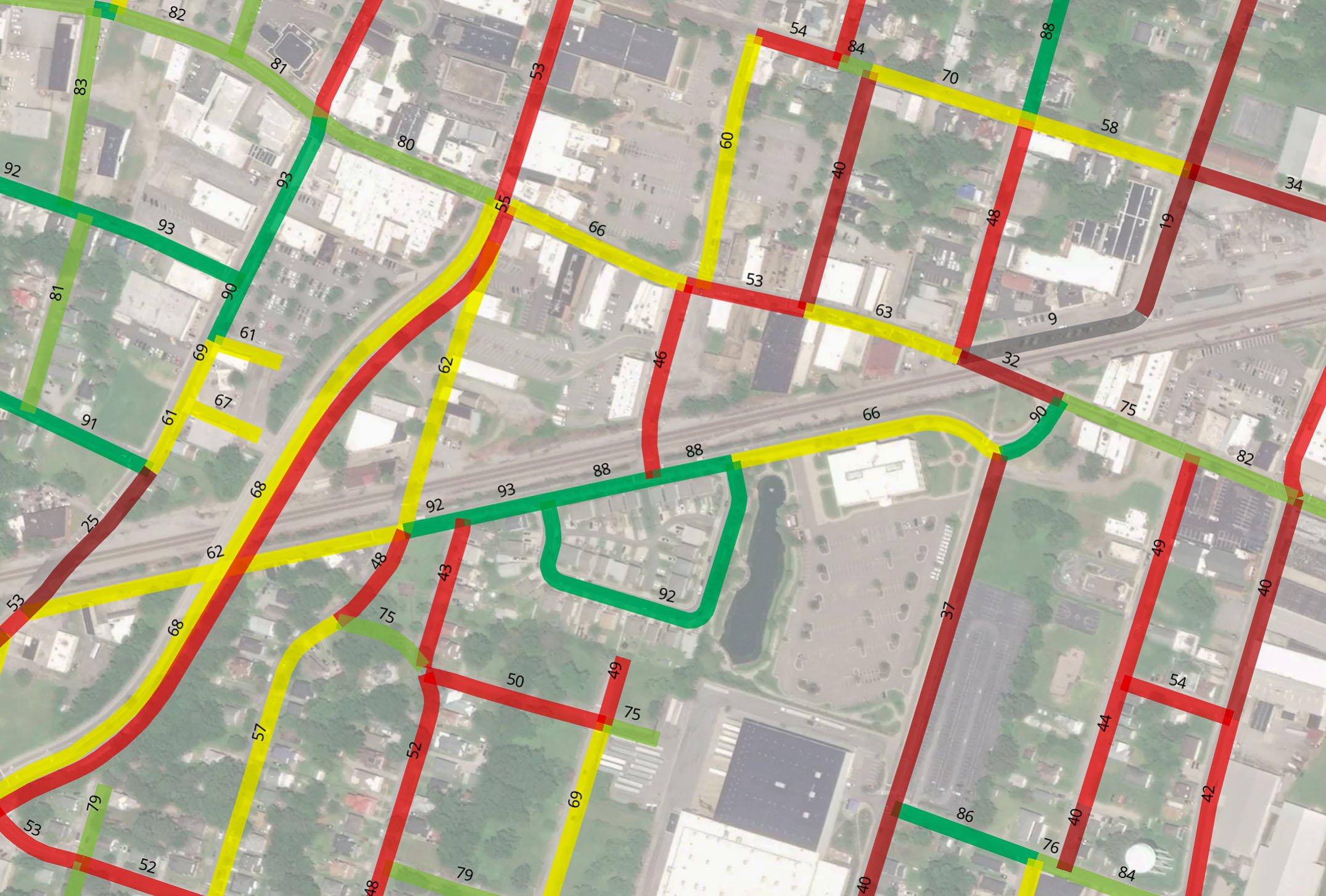
Our pavement management solutions start with our fleet of advanced, data-collecting vehicles that assess the condition of a city or county's pavement network. Equipped with cutting-edge technology like ground-penetrating radar, panoramic camera systems, and Laser Crack Measurement Systems (LCMS), we drive all roadways identified in the agency's GIS centerline file to collect pavement distress data. This data is then uploaded into our web-based mapping platform, SLICER, to evaluate the condition of roads, trails, and parking lots. Using this data, we generate a Pavement Condition Index (PCI) map that prioritizes necessary repairs.
Our data, including web-based images, PCI maps, and more, helps agencies make informed decisions on repair and maintenance budgeting, which can shift based on environmental factors. With limited road maintenance resources, our goal is to maximize value, ensuring residents experience safer, more comfortable, and convenient roads.
Efficient roads mean better performance. Our data and asset management solutions help agencies allocate funds effectively and provide accurate information that may qualify them for additional Federal project funding.