The Hidden Cost of Inaccurate Roadway Surveys
When Small Errors Create Big Problems
Roadway surveys are the foundation of almost every infrastructure decision, from how projects are designed to how maintenance budgets are spent.
Accurate survey data enables agencies to plan, prioritize, and maintain safe, resilient roadway networks. But if the data is even slightly off or incomplete, the consequences can extend well beyond the survey itself.
There is a common misconception that minor inaccuracies in roadway surveys are harmless. The belief is that minor errors won’t materially affect outcomes. The truth is that small errors compound over time. What starts as a mismeasurement or an incomplete dataset can quietly influence design assumptions, skew budgets, and misdirect maintenance strategies.
The actual cost of inaccurate roadway surveys doesn’t always show up on the project invoice. It shows up later as rework, accelerated deterioration, safety risks, and higher lifecycle costs.
By understanding how minor errors create significant problems, agencies can better appreciate why investing in accurate, reliable roadway data is not just a technical necessity, but a long-term financial safeguard.
Roadway Surveys and Infrastructure Decision-Making
Roadway surveys provide the foundational data that agencies use to analyze and understand their roadway networks. Accurate survey data feeds directly into asset inventories and condition assessments, helping teams identify what assets exist, where they are located, and how they are performing. This information supports capital planning by guiding decisions on when to maintain, rehabilitate, or replace roadway assets before costs escalate.
Data accuracy is also critical for effective budgeting and scheduling. Reliable information allows agencies to prioritize work based on actual conditions, align funding with needs, and develop realistic project timelines. When data is incomplete or inaccurate, budgets can be misallocated, critical projects may be delayed, and resources may be misdirected to lower-priority areas.
The effects of flawed baseline data extend far beyond just a single project. Minor errors can cascade through asset management systems, skewing long-term forecasts and weakening planning models. Over time, these inaccuracies make it more challenging to implement proactive management strategies. This often leads to reactive decisions that increase both costs and risk exposure. Accurate surveys enable better decisions at every stage of infrastructure planning.

Pavement Condition Index
Common Sources of Inaccurate Roadway Survey Data
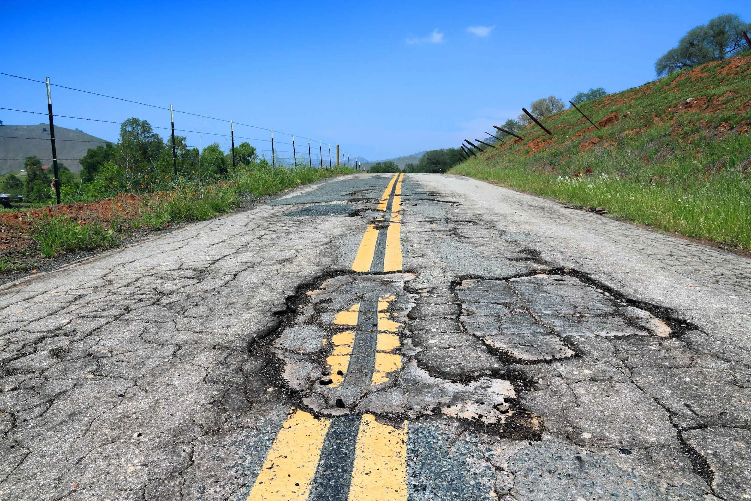
Inaccurate data is rarely caused by a single mistake. More often, it results from a combination of outdated practices, process gaps, and challenging field conditions. One common issue is reliance on legacy data or data collected too infrequently. Road conditions can change quickly due to traffic volumes, weather, and utility work, and surveys that are several years old may no longer reflect current realities.
Human error can also be a contributing factor. Even experienced teams can make mistakes during data capture, processing, or interpretation. This can happen when working with large datasets or manual workflows. Inconsistent documentation, unclear classification criteria, or limited quality control can allow minor inaccuracies to go unnoticed until they affect decisions later.
A lack of standardized data and collection methods can further complicate accuracy. When different jurisdictions, consultants, and vendors use varying survey methods (such as single-lane/single-direction data collection and partial data processing) and different definitions or reporting formats, it becomes difficult to compare or integrate data into asset management systems. These data inconsistencies introduce gaps, misalignments, and confusion across planning efforts.
High traffic volumes, limited access windows, poor lighting, and adverse weather can restrict data collection or reduce visibility of roadway features. While these factors can often be unavoidable, failing to account for them can compromise data quality. Addressing these familiar sources of error is essential to improving confidence in roadway survey results and the decisions built on them.
The Costs That Don’t Show Up on the Bid Sheet
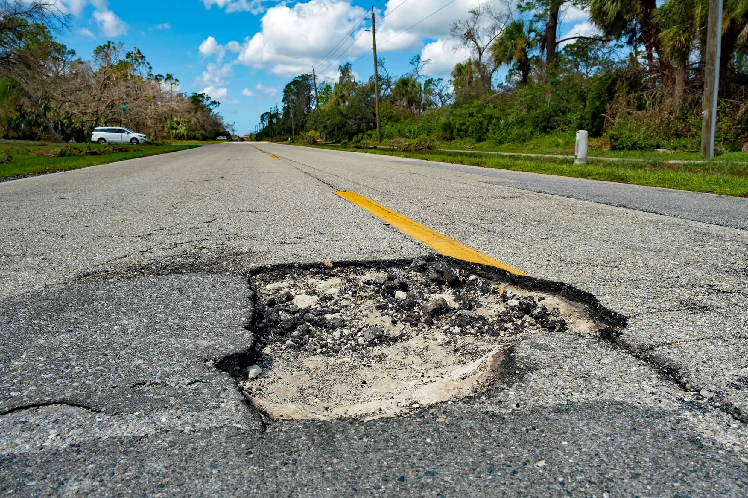
The financial consequences of inaccurate data often emerge long after a project is awarded. Incorrect survey information can trigger project redesigns, expensive change orders, and construction delays, all of which can drive up costs that were never accounted for in the original bid. These adjustments not only strain budgets but also disrupt schedules and impact coordination.
Inaccurate data can also impact maintenance timing. Roads may receive treatments too early, wasting limited funds, or too late, allowing deterioration to accelerate and requiring more expensive repairs. Over time, this results in either over- or under-allocation of funding, diverting resources from the areas that need them most.
The cumulative effect is higher lifecycle costs for roadway assets. When decisions are based on flawed data, agencies spend more over the life of the network to maintain acceptable performance. Investing in accurate surveys helps to avoid these hidden costs and supports more efficient, long-term planning.
The Operational and Safety Consequences of Inaccurate Data
Inaccurate roadway data can significantly impact day-to-day operations and compromise public safety. When survey information is flawed, maintenance priorities might be misaligned, causing crews to address lower-priority areas while critical issues go untreated. This reactive approach reduces overall service levels and can often lead to growing frustration among users who experience deteriorating conditions.
Safety risks increase when defects like cracking, rutting, or drainage issues are overlooked or underestimated. These conditions can contribute to accidents, vehicle damage, and unsafe driving environments, particularly for vulnerable roadway users. As conditions worsen, agencies may face increased liability exposure if it is determined that known issues were not properly identified or addressed. Relying on accurate, up-to-date data, agencies can better align maintenance efforts, improve roadway safety, and demonstrate due diligence in managing public infrastructure responsibly.
How Inaccurate Roadway Surveys Undermine Long-Term Planning
Long-term infrastructure planning depends on reliable data. Inaccurate roadway surveys can quietly weaken even the most well-intentioned strategies. When baseline data is flawed, pavement and asset management models become distorted. This can result in forecasts that may underestimate deterioration or misrepresent network needs. This makes it difficult to plan treatments at the right time and manage assets cost-effectively over their whole lifecycle.
Inaccurate data also complicates funding. Agencies may struggle to justify budget requests or compete for grants when the underlying data lacks credibility or consistency. Performance -based planning requirements further amplify this challenge, as unreliable roadway surveys make it harder to demonstrate progress, meet benchmarks, or comply with reporting standards. Over time, these issues limit an agency’s ability to plan proactively and invest strategically. Accurate surveys provide the clarity and confidence needed to support long-term goals and sustainable infrastructure management.
The Value of Modern Survey Technologies
Modern technologies enable agencies to conduct highly accurate, more reliable roadway surveys that provide a current picture of the status of their transportation networks. High-resolution, repeatable data collection allows condition information to be captured consistently over time, making it easier to track changes, identify trends, and verify results. This level of accuracy helps ensure decisions are based on current information rather than on assumptions derived from visual, subjective data.
Better data allows for confidence in decision-making. Engineers, planners, and public works teams can align around an understanding of actual roadway conditions. This leads to more coordinated project development and maintenance strategies. When everyone is working from the same accurate dataset, communication improves, and costly changes are minimized.
Most importantly, accurate roadway surveys support proactive management. Reliable data allows agencies to act earlier in the pavement’s lifecycle with the right treatments. This extends asset life and avoids more expensive repairs down the road. Over time, a proactive approach can deliver measurable long-term cost savings, improve performance, and create a more resilient roadway network that better serves drivers.
Best Practices for Reducing Survey-Related Risk
To reduce survey-related risks, employ established, consistent data standards and collection processes. Clear definitions, standardized collection methods, and uniform reporting formats ensure data can be compared, shared, and integrated across departments and systems. Consistency minimizes confusion and reduces the likelihood of errors entering the decision-making process.
Regular survey updates are equally important. Road conditions change constantly due to traffic, weather, and construction, and outdated data quickly loses its value. By regularly refreshing roadway data, agencies can maintain an accurate understanding of their assets and respond more effectively to current needs.
Strong quality control and validation processes work to protect data integrity. Routine checks, automated analysis, and review help to identify inconsistencies or gaps before they impact planning or budgeting decisions. These safeguards are especially critical when managing large, complex datasets.
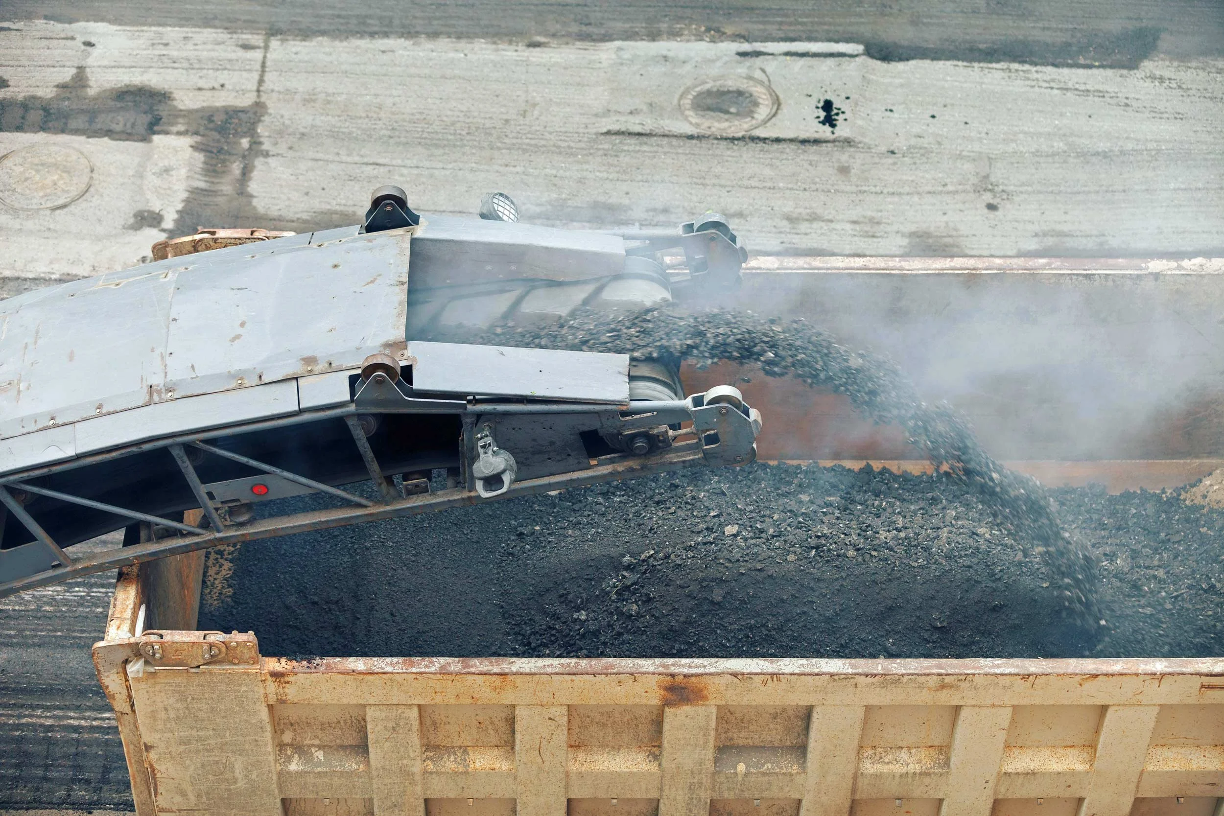
Finally, partnering with experienced survey and data management partners can significantly reduce risks. Qualified, specialized partners bring proven collection methods, advanced technologies, and deep industry knowledge that support reliable, defensible data. Make sure to verify the process. Many companies will only gather data from a test mile. This consists of collecting data on only one side of the road and processing 30-40% of it. This can result in one side of a roadway scoring a high PCI, while the other side posts a failing grade. It’s an inaccurate and costly approach.
At Transmap, we always drive with all our sensors active. That means we collect all lanes and process 100% of the roadway network data. This process provides the most reliable, repeatable, high-quality data. These best practices help agencies build trust in their survey data and make more confident, cost-effective infrastructure decisions.
Conclusion: Investing in Accuracy Pays Dividends
Accurate roadway surveys are a wise, strategic investment that supports more thoughtful planning, better budgeting, and stronger long-term results. While cutting corners on data might seem cost-effective up front, the hidden costs can quickly surface as misallocated spending, premature repairs, safety risks, and higher lifecycle expenses. These impacts are often overlooked until they strain budgets and disrupt operations.
By prioritizing accuracy, agencies strengthen their ability to make defensible, data-driven decisions proactively. Reliable data also reinforces transparency and accountability, which are essential to responsible infrastructure management. In the long run, investing in accurate roadway surveys pays for itself by reducing risk, improving performance, and delivering greater value to the communities that rely on safe, well-maintained roads.
Transmap is a nationwide provider of professional pavement, roadway, and asset management support services to cities, counties, and municipalities. Using our advanced technologies, we provide excellent customer service and robust complete analysis. We are dedicated to maintaining this high standard of data quality while also reducing data collection costs for our clients. To learn more, contact our main office in Columbus, OH at (614) 810–1235.